Skip to content
Click on the links below to view Google Maps of the route and key locations
For Viewers – Parade Route Map
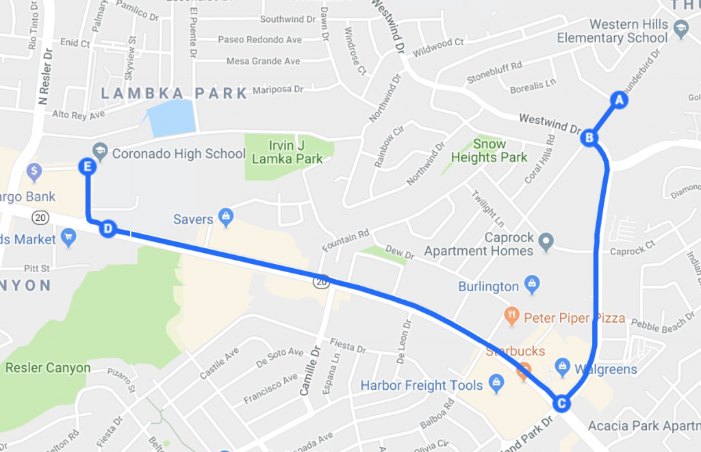
Route Description
- The parade starts at Western Hills Methodist Church (A) on Thunderbird Drive.
- It continues west and turns left onto Shadow Mountain Drive (B).
- It continues on Shadow Mountain and turns right onto Mesa Street (C).
- It follows Mesa and turns right onto Champions Place (D).
- The parade ends whene Champions Place meets Cloudview (E).
- All parade participants are to continue on Cloudview beyond Coronado High School to avoid congestion.